Moderate Risk: PDS watch for damaging winds and giant hail in Kansas
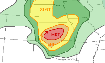
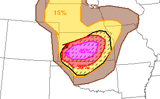
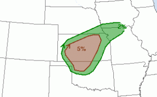
The Storm Prediction Center (SPC) has issued a moderate risk today for severe storms in Kansas and northwestern Oklahoma. The primary risks will be for widespread damaging winds, including gusts up to 75-100 mph, and giant hail up to softball size. There is also a smaller risk for a few tornadoes.
Currently there is a Particularly Dangerous Situation (PDS) severe thunderstorm watch in place for southwest and central Kansas, to northwest Oklahoma, and through the Texas/Oklahoma panhandle.
Initially discrete to semi-discrete supercells are expected to fire this afternoon ahead and along a dry line situated in SW Kansas down through the Texas panhandle. It is expected that as storms move eastward that cell mergers will eventually occur and transform the storm mode into a quick-moving QLCS. This QLCS is likely to contain strong damaging winds as it continues moving east through central Kansas. Previous SPC discussions have mentioned the possibility for a derecho event. It is not yet certain how far east the QLCS wind threat will extend.
What People Are Saying...
Twitter Mentions
Reddit
Jetpack Comments