Tropical Storm Francine Strengthening in the Gulf
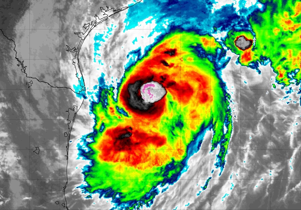
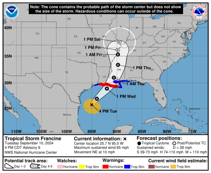
Tropical Storm Francine will likely strengthen into a hurricane over the next 24 hours. The center of Francine is currently sitting off the coast of Texas over 86°F Gulf water, where the heat is fueling its intensification. The latest Air Force Hurricane Hunter data shows that the pressure has dropped to 987 mb, an indication of this strengthening. The storm is expected to continue to move N/NE towards the Louisiana coastline and make landfall on Wednesday afternoon or evening. Until now, Francine has struggled to increase in intensity due to steady dry air entrainment. However, the National Hurricane Center expects the storm to steadily organize and strengthen as it moves north across the warm ocean water.
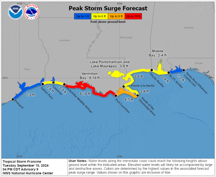
Francine will likely bring dangerous conditions to Louisiana as it moves ashore Wednesday. Threats such as flash and urban flooding, hurricane force winds, and life-threatening storm surge up to 10 ft will be likely. Hurricane warnings have been issued for much of the Louisiana coastline and residents are being asked to finalize their preparations before Francine arrives. Other hazards such as widespread power outages and tornadoes are also possible.
September 10th is considered to be the climatological peak of hurricane season.
Severe Studios Storm Chaser Jordan Hall will be doing live coverage of the storm from the Louisiana Coast. You can see his updates on his social media at https://x.com/JordanHallWX and https://www.facebook.com/JordanHallWX/
What People Are Saying...
Twitter Mentions
Reddit
Jetpack Comments