Ian continues across Florida Makes Landfall As a Cat4
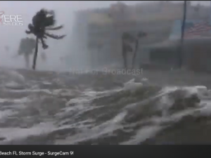
We continue to track as Hurricane Ian continues across Florida As a Category 4 Storm. Our chasers are safe, and in-route to pick Ian back up as a hurricane, again, somewhere around the North Charleston, South Carolina area. We’ll be reporting and live streaming a SECOND intercept of Ian. Our fallen hero, Surgie Cam-9 captured a phenomenal mesovortex as the eyewall of Ian was closing in on itself as it continued to weaken, eventually dwindling back to Tropical Storm status over most of central Florida on Thursday.
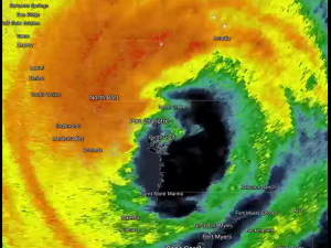
Hurricane Ian made landfall Wednesday afternoon at 3:05pm Eastern Time as was captured by SevereStudios Surgie-Cameras and seen all across the world, and live on The Weather Channel.
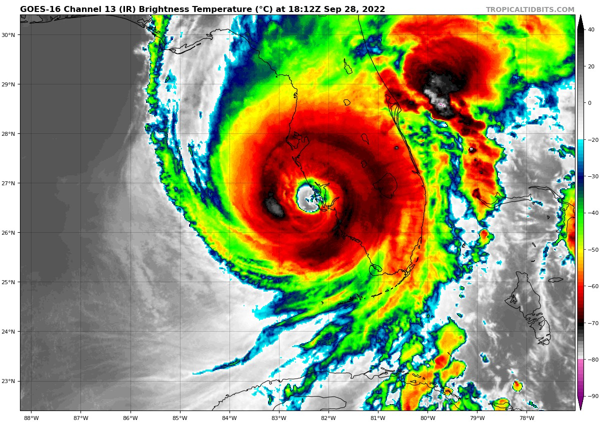
Landfall was reported by the National Hurricane Center to be located in the area of Cayo Costa Island, Florida. This was also the exact location Hurricane Charley, another Category 4 150MPH storm, made landfall on August 13, 2004.
Ian will tie for 4th strongest in Florida history. We have been tracking Hurricane Ian all week in our coverage.
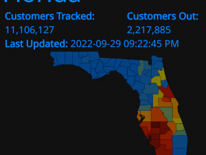
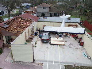
Catastrophic flooding and extreme wind damage, mass power outages with more than two million people across Florida were without power, while some were trapped in flooded homes as Hurricane Ian Continues across Florida.
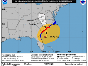
Now Tropical Storm Ian, is expected to restrengthen to a hurricane in the Atlantic before making a currently projected landfall with South Carolina in its track.
Follow @SevereStudios Twitter for LIVE updates and Subscribe to the SevereStudios Youtube Channel for the latest extreme weather videos and live storm chasing action as Ian continues across Florida.
What People Are Saying...
Twitter Mentions
Reddit
Jetpack Comments
Comments are closed here.