Moderate Risk Today
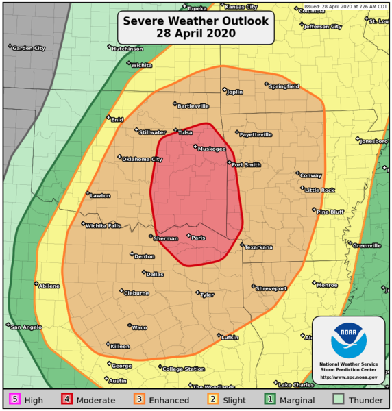
There is a Moderate Risk for severe weather today in parts of the Southern Plains and the Ozarks. This includes Broken Arrow and Muskogee, OK, Fort Smith and Van Buren, AR, and Paris, TX.
All modes of severe weather will be possible. This includes a few tornadoes, hurricane force winds, and hail up to baseball size.
Tuesday, April 28 Tornado Outlook
Tuesday, April 28 Wind Outlook
Tuesday, April 28 Hail Outlook
An Enhanced Risk encircles today’s Moderate Risk and includes much of the Southern Plains. In this area, damaging wind gusts and large hail will be the primary threats. A few tornadoes will also be possible.
Tuesday, April 28 Severe Weather Outlook
Follow us on Twitter for the very latest.
What People Are Saying...
Twitter Mentions
Reddit
Jetpack Comments