Southern Severe Threat Continues

Severe weather will continue to be possible across parts of the Southern U.S. the next few days.
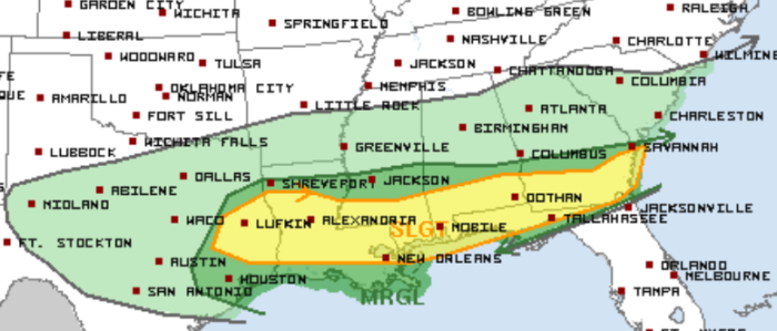
Today’s Slight Risk area stretches from far east Texas to coastal Georgia. This includes New Orleans and Baton Rouge, LA, Mobile, AL, and Tallahassee, FL.
Wednesday, March 4 Severe Weather Outlook
The greatest risk for any tornadoes today is in that Slight Risk area.
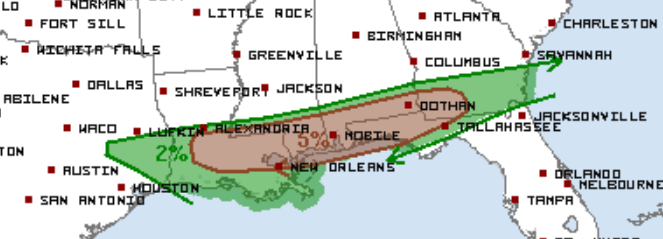
Wednesday, March 4 Tornado Outlook
A Tornado Watch is already in place for parts of Alabama, Georgia, and Florida until 6 PM ET. A couple tornadoes are possible along with wind gusts to 70 mph and hail greater than 1″ in diameter.
Tornado Watch
The severe threat will linger into tomorrow for parts of the Southeast before the pattern quiets for the weekend.
Tomorrow’s Slight Risk includes many of the same areas, including Dothan, AL and Tallahassee, FL.
Thursday, March 5 Severe Weather Outlook
What People Are Saying...
Twitter Mentions
Reddit
Jetpack Comments
Comments are closed here.