Severe Threat Ramps Up
UPDATE —
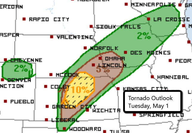
The Storm Prediction Center has upgraded the severe risk for north central Kansas to MODERATE. Very large hail and a few strong tornadoes will be possible with any storms that develop this afternoon and evening.
Make sure you have multiple ways to receive severe weather alerts.
PREVIOUS —
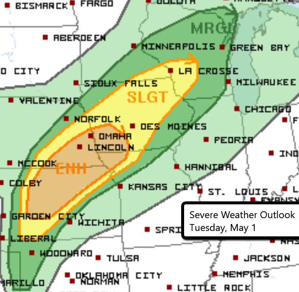
The threat for severe weather ramps up today for parts of the Central U.S. An Enhanced Risk is in place over parts of Kansas, Nebraska, Iowa and Missouri.
Storms developing this afternoon and evening could produce large hail, damaging wind gusts and even tornadoes. The greatest threat for tornadoes is in north central Kansas including Salina, Junction City and Great Bend. There is the potential for overnight severe weather, including isolated tornadoes. If you live in these areas, make sure you have a way to receive severe weather alerts even when you are sleeping.
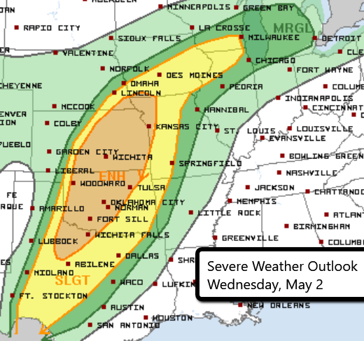
The active weather continues into mid-week with a larger Enhanced Risk area on Wednesday stretching from far southwestern Iowa into north central Texas. Again, hail, strong winds and tornadoes will be possible.
Follow us on Twitter for breaking severe weather info.
What People Are Saying...
Twitter Mentions
Reddit
Jetpack Comments
Comments are closed here.