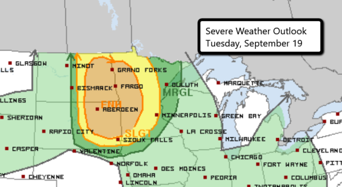
Northern Plains Enhanced Risk
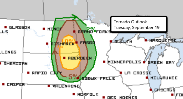
A late season Enhanced Risk is in place today and tonight in parts of the Dakotas and Minnesota. Storms are expected to develop later this afternoon across central/eastern North and South Dakota. Supercell development is likely and a few tornadoes will be possible with this initial storm initiation.

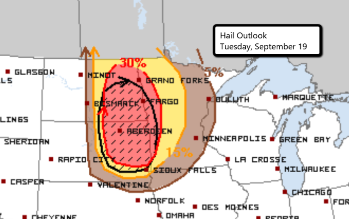
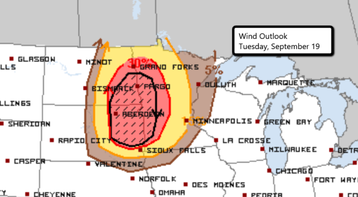
Large hail and damaging wind gusts are likely as well. The Storm Prediction Center warns that a few of these events “should be significant.” Hail and wind will continue to be the primary threats as storms merge into a line and race across western Minnesota late tonight.


Follow us on Twitter for the latest updates.
Watch live chasers in the field here.


What People Are Saying...
Twitter Mentions
Reddit
Jetpack Comments