Severe Risk from Texas to Ohio
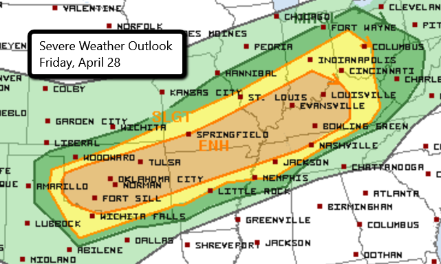
There is a widespread risk of severe weather today from parts of north Texas to western Ohio. Storms are expected to develop later this afternoon and continue into tonight. The Enhanced Risk area stretches from Oklahoma into southern Indiana and central Kentucky. This includes Oklahoma City, Tulsa, Lexington and Louisville, KY and Springfield, MO.
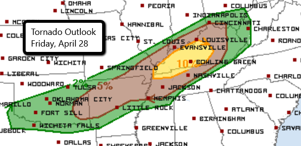
Any storms that develop today in these areas have the potential to produce large hail, damaging wind gusts and even a few tornadoes. The greatest risk for tornadoes is over central and western Kentucky. This does include Bowling Green and Paducah, KY.
It’s important that you have multiple ways to receive severe weather alerts no matter where you are or the time of day!
Follow us on Twitter for updates.
Watch chaser live streams here!
What People Are Saying...
Twitter Mentions
Reddit
Jetpack Comments