Flash Flooding Threat for Minnesota and Wisconsin
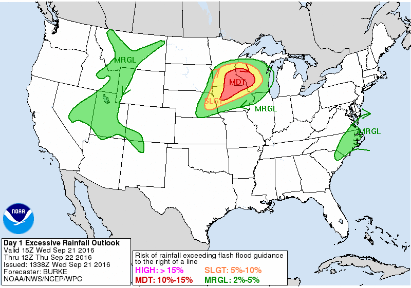
A stationary front draped over southern Minnesota and central Wisconsin could cause some issues over the next few days. Showers and storms that develop late Wednesday and continue into Thursday will dump anywhere from 2-4″+ for parts of southeastern Minnesota and western Wisconsin.
Here’s a map of current Flash Flood Watches in effect across the area through Thursday. #mnwx #wiwx pic.twitter.com/eO0SfpXigI
— NWS Twin Cities (@NWSTwinCities) September 20, 2016
The Twin Cities NWS has issued a Flash Flood Watch until Thursday evening because of expected multiple rounds of very heavy rainfall. Some locations, especially in southeastern Minnesota, have already picked up well above average amounts of rain over the past few months. The risk for flash flooding is heightened in those spots.
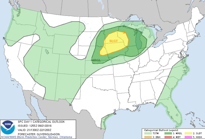
Severe Weather Outlook for September 21, 2016
Along with excessive rain, a few storms that develop later today could be severe. The initial risk with developing supercells will be large hail and even a tornado or two. This will shift towards a damaging wind potential throughout the rest of the evening.
What People Are Saying...
Twitter Mentions
Reddit
Jetpack Comments